

NORTH HILL VILLAGE (CHURCHTOWN) |
|||||
|
|||||
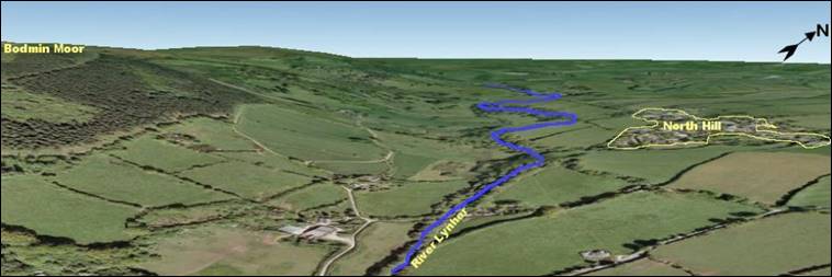
The location of North Hill village or Churchtown owes much to the local geography. As will be seen below, the site may have been a northern outpost of the Manor of Rillaton where people worked and lived but were controlled by the manor.
|
The site is just beyond the north eastern fringe of Bodmin Moor which provides a degree of protection from the wind and rain which comes primarily from the south west. The moor also provides an abundance of building materials in the native granite and woodland. It is close to the River Lynher which provides an inexhaustible supply of fresh clean water as well as the motive power to drive millwheels. The land on the west side of the Lynher is steep and more difficult to farm which explains why a location on the eastern side of the river was chosen. A gently sloping platform of land on the eastern side and immediately to the north and east of the village was better suited to farming both animals and crops. Being located over 100 feet above the Lynher the site is dry, well drained and affords excellent views around the nearby countryside, particularly from the top of the church tower; it was always worth having advance notice of ‘visitors’, particularly when the country was in turmoil. Being only six miles from Launceston, which was the county town of Cornwall and the location of the Priory of St Stephen, this gave the local people a proximity to news, administration, markets and protection. |
||||
 | |||||
The origins of the name “North Hill” |
Here is a theory. Do you have another explanation? According to the noted Victorian historian Francis Hingeston-Randolph the earliest recorded extant mention of North Hill as a place was in 1291 when it was written as “Northulle” and was in the hundred of Estwyvelschyre (East Cornwall). From his reading of ancient documents he further mentions the parish in this form in 1333 and 1345. In 1349 he records an instance of “Northhulle”. The earliest known recording of “North Hille” was in the early 1600s. Since then there have been various corruptions but all are variants of the modern version “North Hill”. The incidence of names for South Hill, on the other side of Linkinhorne parish is almost parallel in dates and word structure moving from “Southulle” to “South Hill”. |

|
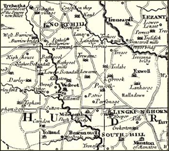
The two names North Hill and South Hill represent areas which were northern and southern parts of the Manor of Rillaton, close to the village of Rilla Mill in Linkinhorne parish, which was once the administrative centre of the area. This manor is acknowledged as one of the most important mediaeval settlements in the region. The first record of Rillaton Manor is in the 881AD will of Alfred the Great, who left the property to his youngest son. Pieces of the stone of the manor house have been located and identified and confirm the belief locally that the house may have been of a style and size comparable to Cotehele on the banks of the River Tamar. It is possible that the two areas of North Hill and South Hill were both wooded areas and the names derive from “North Holt” and “South Holt”, the Saxon for ‘wood’ being ‘holt’. This is how Northolt and Southall in West London got their names. |
|

Carne's Corn Mill is the dark building in the background. More images of the mill can be seen here. |
|
|
||
The image at the top of the page shows North Hill in 2009. |