


OCCUPATIONS |
Farming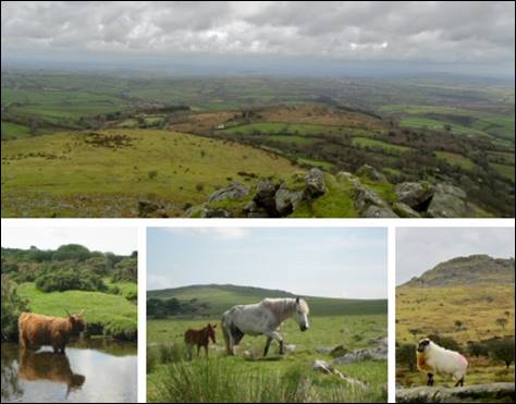
Farming has been the staple occupation in North Hill parish for centuries. The geography of the parish determines how the land is used. The higher land to the west of the River Lynher is open moorland known as Twelve Men’s Moor. This area has no significant value in terms of crop production and so it is left to the animals to graze on the bleak and boggy uplands. Cattle, sheep and ponies are the permanent moor residents as can be seen in these images, although there have been times when other farm animals have lived up on the moor. Follow the link above to Twelve Men’s Moor to see what happened when one farmer took it upon himself to graze more animals on the moor than he was allowed. 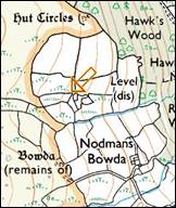
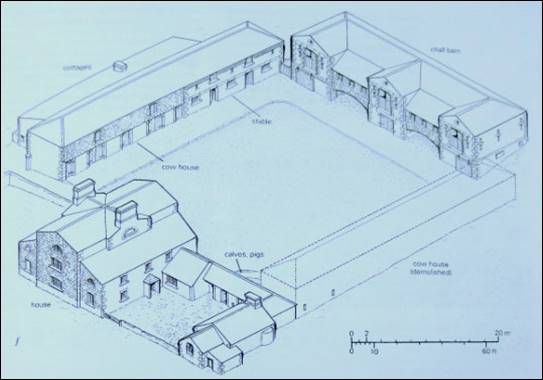
There are ancient fields, perhaps dating back into the bronze age, scattered around the edges of the moor. These are closer to where the farmers lived and where animals were kept when not allowed free on the moor. The high banked lanes leading off the moor were sometimes used for penning livestock which had been brought off the moor whilst other animals were tracked down to be brought off the moor. The eastern half of the parish and a strip on the west bank of the River Lynher are the typical rolling hills of the valley of the River Tamar. The landscape is divided up into fields where animals graze on pastures which are more lush than those on the moor and the arrangement of these fields are broken up with wooded areas. Cattle are usually kept in these lower, less exposed areas. The field boundaries on the tithe map of 1840 are almost exactly those which can be seen today. Many of the farm buildings date from this time or earlier. The farms which were owned by the Duchy of Cornwall were built and operated to a standard model. The style of farm buildings can be seen at Trebartha Barton (pictured in the diagram below), Botternell and Lynher Farm as well as others in the parish. In 1997 the Royal Commission on Ancient Monuments reported on “English Farmsteads 1750-1914” and North Hill farms featured strongly in the section on East Cornwall. |
|

|
|
|
Farm machinery was often built locally and both the Buckingham family of Lewarne and Richard Harris of nearby Bathpool constructed many well made machines. The advertisement shown above for Jabez Buckingham’s Mangel and Turnip Ridge Drill was published in Venning’s Postal Directory of 1901 and similar adverts for Richard Harris can be seen there. Farm machinery is still sold and maintained in the parish at RSM Beare in Coad’s Green. |
|
Carne's Corn Mill |
|||
|
Mining |
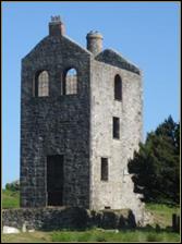 Mining in the parish had the effect of bringing temporary prosperity and population growth to the area. The influx of miners to the area in the 80 years from about 1815 to 1895 increased the number of people living in the parish as can be seen here. Caradon Hill to the south in the parish of Linkinhorne was the largest employer of miners in the area and the Caradon Hill Project Heritage Centre at Minions (pictured here) is located in an old mine engine house where the story of mining in the area is presented to visitors. There are no engine houses left in North Hill parish but tucked away in corners and in bits of woodland there are the remnants of the mine buildings and mine workings. The mines were built to extract the metal ores created millions of years ago when the bubbling mass of molten granite cooled to form what is Bodmin Moor today, changing the composition of the surrounding rocks and forming veins of metal ores to spread out from the moor. Tin, copper, zinc, wolfram and other ores have been mined in the parish. There are mines and miners’ cottages scattered around the parish from the edge of the moor to the extremities of the parish around Lanoy. The last working mine, Hawkswood Mine, closed in the 1950s. |
Quarrying |
|
|
Quarrying has provided the parish and many places beyond with building materials. The granite of Bodmin Moor makes an excellent construction medium and even Westminster Bridge in London is made from granite quarried on Twelve Men’s Moor. Whilst there are still large numbers of surface rocks lying around they form part of the natural beauty of the area and would not provide enough material of the right shape or quality. Ian Piper’s quarry on Twelve Men’s Moor above Blackcoombe Farm is still active and Ian has given talks to local groups on the quarry’s workings and where the stone has gone for use. An ochre quarry existed in the west of the parish and we’d love to be able to tell our readers more about this. Can you help? |
|
Timber |
|
|
The Trebartha Estate had a saw mill at Stonaford. This image, possibly from the 1930s, has been provided and published here with the permission of Vernon Dawe whose grandather, Fred Cole, is shown here with the horses. Fred's brother in law, Cyril Sleeman, is on the saw bench. Vernon's question is ... Can you identify this as the Stonaford saw mill, or was that water driven? Answers please by e-mail to the webmaster. Thank you.
|
|
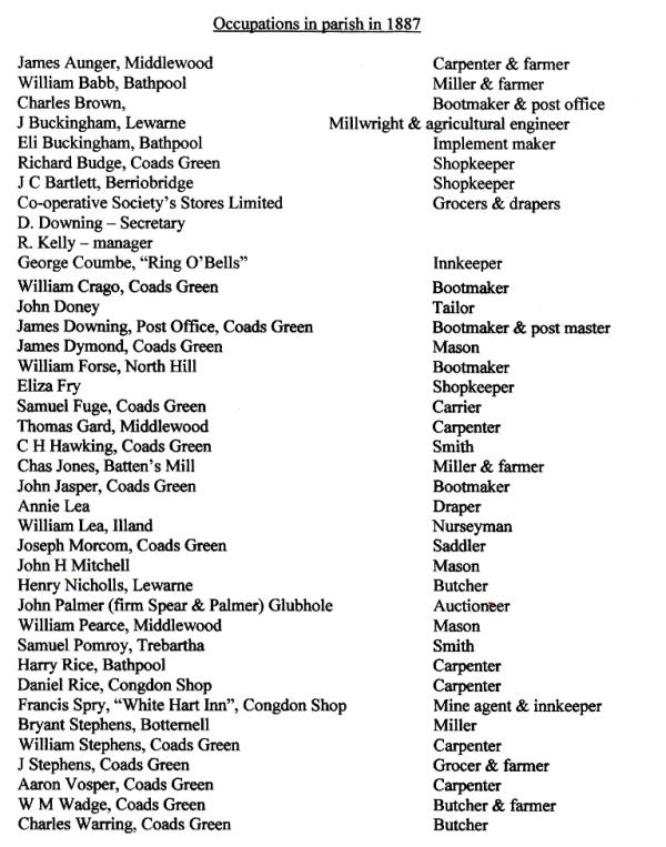
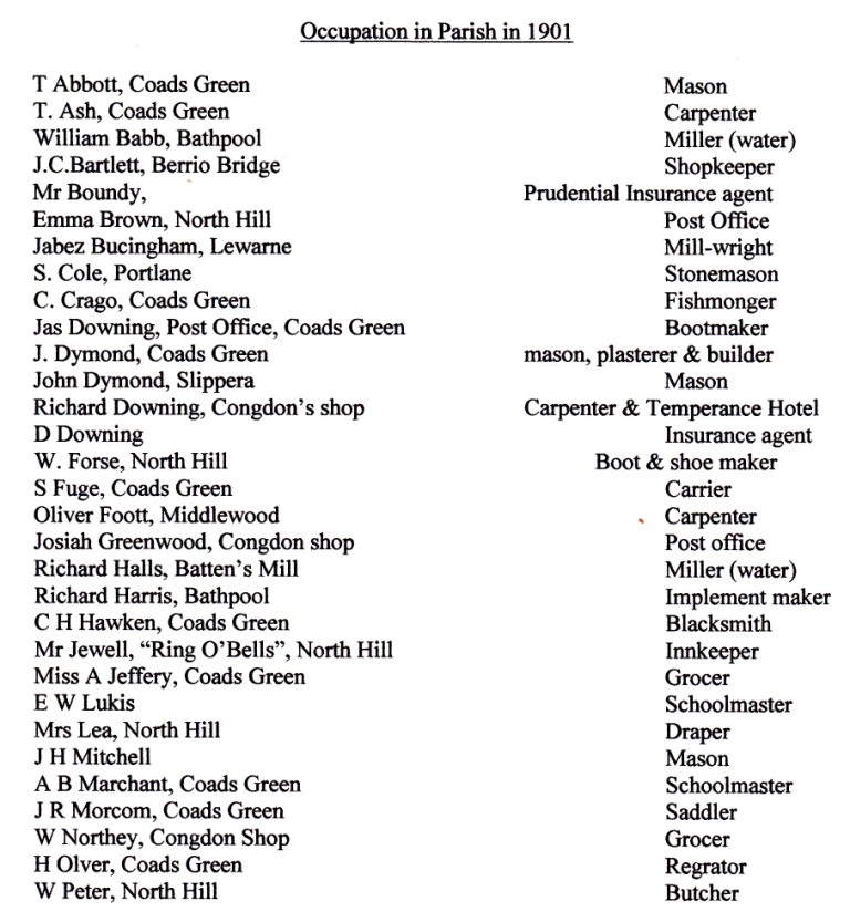
Occupations in the parish in 1887 and 1901 |
|
  |
|
The four images at the top of this page show (L-R): Haymaking in North Hill; Mine Engine House; A prize Aberdeen Angus in the hands of Bill(?) Budge; Ian Piper’s quarry. |