
PLACESThe places names of the parish have been derived from the physical geography and human influences. Being part of Cornwall but so close to Devon there is a mixture of English and Cornish language roots in the place names.The west of the parish is dominated by the granite hills which form the eastern flank of Bodmin Moor. From East Moor and Twelve Men’s Moor the granite outcrops of Hawk’s Tor, Kilmar Tor and Bearah Tor look down onto the rolling hills which form the valley of the River Lynher. The Lynher crosses the parish and drains into the River Tamar. |
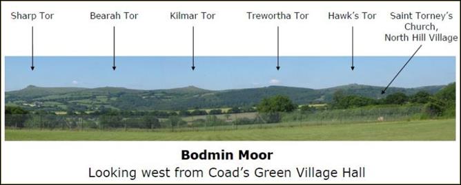 Looking west across the parish from Coad's Green to Bodmin Moor.from the north west to the south east. |
People have lived in the parish for thousands of years. Up on the wild expanses of Twelve Men’s Moor in the west of the parish can be seen Bronze Age settlements. As the people became more civilized and cleared the lower lying land so they moved down into the lower, less exposed, areas. Prehistoric settlements abound on the moor and a reconstructed Bronze Age village can be found at Trewortha. You can read more about the settlement in the parish. |
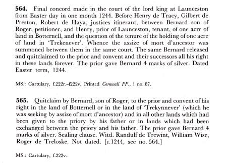
The Cartulary of Launceston PrioryPlaces in North Hill parish are recorded in the Cartulary of Launceston Priory. A cartulary is a medieval manuscript containing transcriptions of original documents relating to the foundation, privileges, and legal rights of ecclesiastical establishments such as the Priory of Launceston which was founded in the 1120s. It owned a large collection of properties in the Launceston area, including land in the modern day parish of North Hill. The cartulary gives information about many aspects of the Priory's existence, including its tenants, land dealings and boundaries as well as dealings with local laypeople. There are more examples of the documents contained in the cartulary on the Battens page |
||
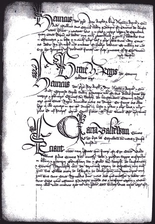 A typical page from The Cartulary of Launceston Priory. |
   |
|
The parish of North Hill (Bre Gledh in Cornish) is about six miles south west of Launceston, once the county town of Cornwall. The parish has two village centres at North Hill village, occasionally referred to as Churchtown, and Coad’s Green. Other centres of population in the parish are Bathpool, Berrio Bridge, Lanoy, Middlewood and Newtown. The parish population is usually between 900 and 1000 people. Thomas Moule writing in his 1838 description of “The Hundred of East” records “NORTHILL, 7 miles S.W. from Launceston, contains 153 houses and 1089 inhabitants, including the hamlets of Trebartha, Treveniel, and Illand. The church, dedicated to St. Torney, is a rectory, value £36 6s 8d”
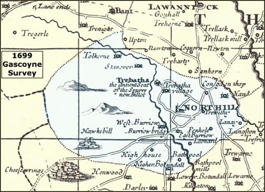
The parish church of St Torney is in North Hill village and the holy well of St Torney is situated by the River Lynher. To the west of North Hill village is Trebartha where Trebartha Hall can be found. This was the home of the influential Spoure and Rodd families. Coad’s Green has its own Methodist Chapel and village hall. The parish war memorial is situated at Congdon’s Shop midway between North Hill village and Coad’s Green. There were once Wesleyan Methodist chapels at North Hill, Coads Green, and Bathpool and Bible Christian chapels at Middlewood and Congdon's Shop. The war memorial is at Congdon’s Shop where the B3254 meets the B3257. There is one school in the parish, Coad’s Green Primary School. The only public house left in the parish is The Racehorse in North Hill village. North Hill has an active association football (soccer) team. |
|
Seven of the present day settlements were recorded in the Domesday Book, viz: Illand, Landreyne, Penhole, Tolcarne, Trebartha, Trefrize and Treveniel. You can read more of the Fee of Treveniel on the Launceston Then! website. For centuries the North Hill parish economy has been based upon three main occupations of farming, mining for metals and quarrying for granite. There are now no active mines in the parish but quarrying continues and farming is still the main source of employment for those working in the parish. In recent years tourism has increased in importance. Many current residents commute to larger centres of population to work.
|
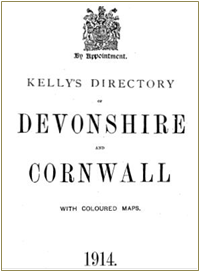 Click on the image of Kelly’s directory to see who was living in the parish and what they were doing over 100 years ago. |
We’d love to publish some histories of other places in the parish.If you would like to put together something on the history of the following places, for example, and send them in to our secretary for publication we’d be delighted (don’t worry about making it look nice, we can do that for you): Bathpool, Kingbear, Stonaford, Slipper Hill and Middlewood etc. You may wish to see what we have done with Jim Edward’s recollections. |
The images at the top of the page show (L-R):
|

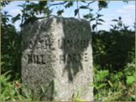 North Hill is bounded by the neighbouring parishes of St Cleer, Altarnun, Lewannick, Lezant and Linkinhorne. The boundaries of the parish are marked in many places by ancient stones; an example can be seen in the first picture at the top of this page. The process of ‘Beating the Bounds’ takes place from time to time, the last occasion being in 2013.